I have a couple of pointer dogs and they and I prefer getting away from town life to walk. They can range, so I've sought out areas where I can see for miles. Margate is perfect for getting out into the wilds, with miles of raw beaches. Often in high season, you can be on a beach all to yourself. Which is what makes the Thanet coastline, so remarkable. Really, where else is there within easy reach of London can you hit empty beaches of such beauty in July and August?
One of my favourite walks is through the network of lower flatland fields and channels below the shoreline between Minnis Bay and Reculver. I used to reach these from the seawall walk that runs between Minnis Bay and Reculver. I had often wondered how I could get to the network of fields and tracks that run the other side of the railway line. So I got myself an Ordnance Survey map of Thanet.
As the owner of wayward hunting dogs, finding open country with public rights of way was crucial. I can't walk my dogs off lead in parks surrounded by traffic and Margate is surrounded by hectares of fields. Most of these rights of way aren't signposted.
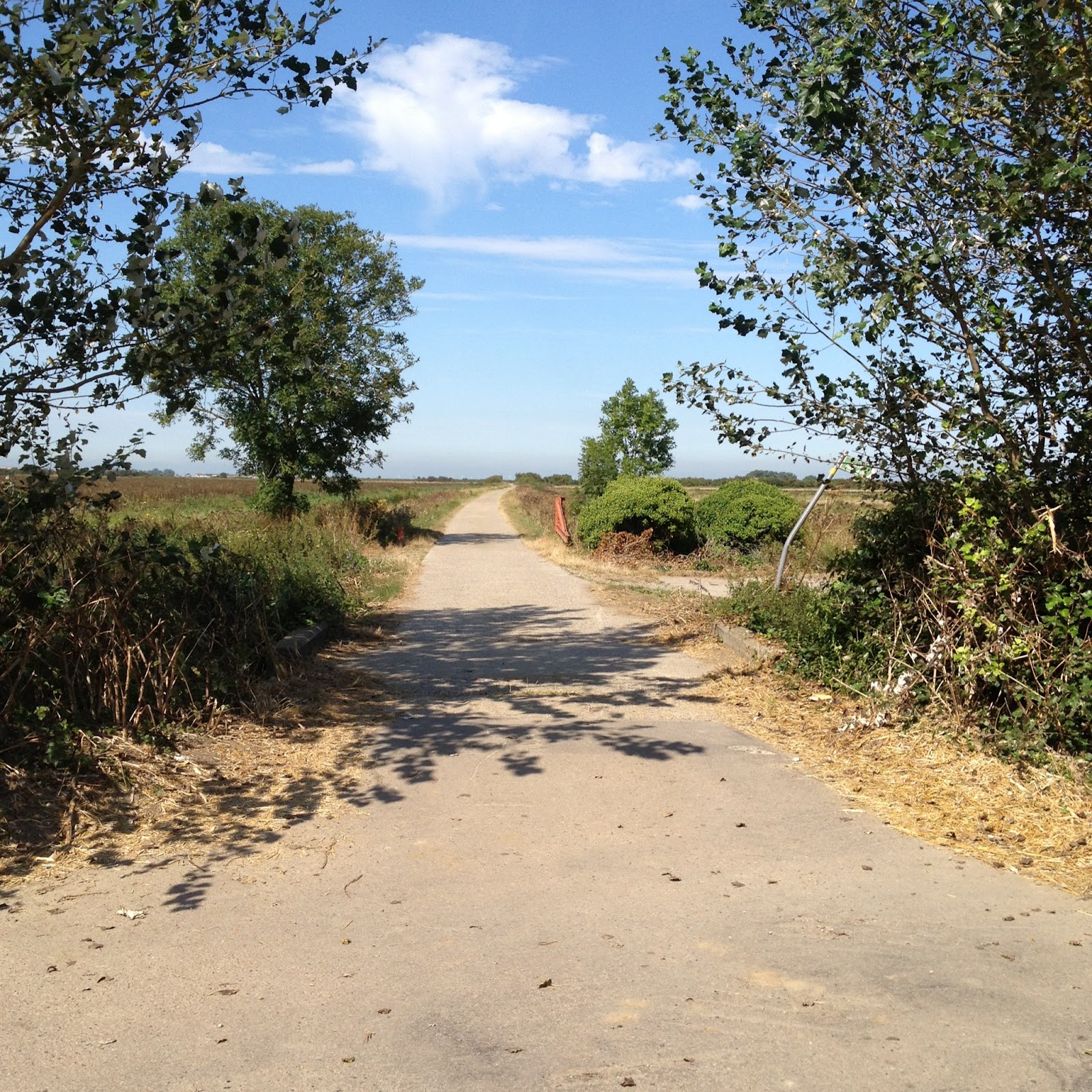 |
Start of the walk
|
I start this walk by parking up at a group of farm buildings off the old Thanet Rd. There is a concrete track running towards the direction of the sea. It's locked by a gate. Reculver lies to the left at approximately eleven o'clock in the distance and Minnis Bay to the right.

The fields on either side of the track can be explored. There can be bunnies! The track has a ditch running along side. Mine go in for drinks and do come out stinking. So beware!
At the top of the track is a river which is a private fishing club. There are rich hedgerows here: sloes, hawthorn, rosehip and blackberries. I've found them to be a month behind the other side of the railway tracks. You can choose to walk along the side of the riverbank below the hedgerows or above on a dirt track. The route is part of the Wantsum Walk.

Take care if you have a dog as you approach the railway line level crossing. You can see the trains coming from a long distance. But make sure you have your dog on lead in case. Once over the crossing you can choose to go left to Reculver, right to Minnis Bay or straight ahead to the sea.
Personally, I like to go straight ahead so I leave the train line behind me. My dog chases trains! The water channel snakes out from the sea and again, you can choose to walk along the river bank or above on a dirt track. The raised seawall ahead with runners, walkers and cyclists. But far less busy than the stretch of walk closer to either end at Reculver or Minnis.
 |
| river after the railway track |
 |
| Minnis Bay in the far distance |
 |
| Shoreline ahead |
 |
| Apple tree along the path |
Coming up off the fields on to the seawall pathway, there is Reculver to the left.

The beach here is shingle. It has an atmosphere akin to Dungeness. Some kind of strange type of fennel grows in abundance in frothy beds. A different type than found at Pegwell Bay. I'm not sure it's even edible! It smells like fennel but didn't taste like it. It's a fantastic spot to view wild birds.
 |
| Perfect for paddling at half way in the walk |
 |
| Add caption
I either go on towards Reculver, but stay in the lower fields or I return down the path I came on to get back where I started. Here's a map of the walk on Google Maps.
|
No comments:
Post a Comment